DificilAccesibil Iarna
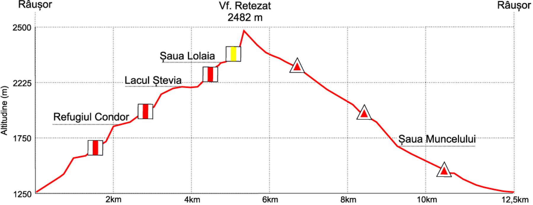
Râușor – Lacul Ștevia – Șaua Lolaia – Vf. Retezat – Valea Valareasca
Durată
10-11 ore
Distanță
24 km
Descriere
Expediție completă ce îmbină lacuri alpine, creste montane și vârful legendar Retezat. Pentru alpiniști experimentați care caută o aventură de neuitat pe culmile Carpaților.
Detalii Traseu
Râușor → urcare Valea Șteviei admirând flora alpină → trecere pe lângă Refugiul Condor → oprire opțională la Lacul Ștevia → escaladare Șaua Lolaia → cucerire Vf. Retezat (2482m) → traversare spectaculoasă pe Culmea Prelucele → coborâre prin Valea Valareasca → închidere traseu la Râușor.
Mai Multe Trasee de Explorat
Vezi Toate TraseeleFotografii trasee cu permisiunea A.P.N. Retezat (www.retezat.ro) - utilizate în scop educațional și pentru promovarea turismului.