DifficultWinter Accessible
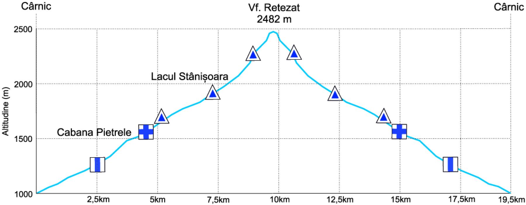
Cârnic – Pietrele Cabin – Stânișoara Lake – Retezat Peak
Duration
10-11 hours
Distance
22 km
Elevation Gain
+1680m
Trail Marking
Blue band to Pietrele Cabin, then blue triangle to the peak
Description
Alpine adventure to Retezat Peak, one of the giants of the Southern Carpathians. The trail challenges you with sustained climbs but rewards you with stunning views of the Gemenele Reserve and surrounding mountains.
Route Details
Start Cârnic → hike through forest to welcoming Pietrele Cabin → continue to Stânișoara Lake (2000m altitude) → technical and demanding climb to Retezat Saddle → final push to summit through rocky terrain → descend same route or variant through parallel valley.
Photo Gallery

Trail Information
DifficultyDifficult
Duration10-11 hours
Distance22 km
Elevation+1680m
MarkingBlue band to Pietrele Cabin, then blue triangle to the peak
Winter AccessYes
Safety Notice
Mountain hiking requires proper equipment and preparation. Check weather conditions before departure and inform others of your route.
More Trails to Explore
View All TrailsTrail photos provided with permission from A.P.N. Retezat (www.retezat.ro) - used for educational purposes and tourism promotion.